Extreme Weather Modules
December 2024
Extreme wet weather is becoming an increasing challenge across the British Isles and has affected nearly every organisation that we work with over the last few years.
In response to this we have been implementing new and improved HIAMS modules across the country to support extreme wet weather management.
These modules have been developed for customised requirements, but the systems are available widely, to support individualised requirements, so please get in touch if you would like to discuss how our software can support your efforts to minimalize wet weather disruption.
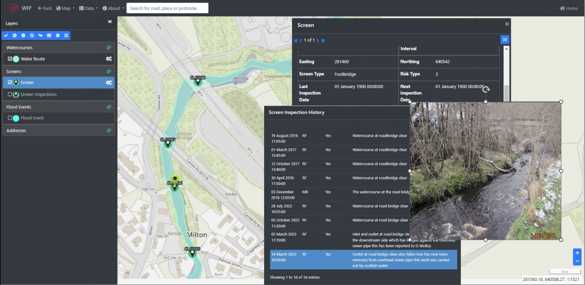
Flood Risk Management System
The FRMS module was developed ten years ago as a Windows based tool. In addition to keeping up to date with current inspection & risk management processes, it has been updated to make use of the web-based HIAMS asset management tools.
The system is used primarily to manage authorities’ requirements to:
- maintain an inventory of the watercourse networks in their area.
- schedule and manage inspections of watercourses and defects repairs.
- manage assets on the watercourses, and inspections on these assets e.g. Screens, SuDS etc.
- record flood events and monitoring of high-risk sites.
Drainage Module
The drainage module has been developed to manage Welsh Government assets, including:
- drainage assets.
- various inspection types undertaken on their drainage assets and reporting.
The WIP system includes powerful tools to allow complex assets to be displayed using combinations of line types/colour/thickness etc. and arrows showing direction of flow. It also manages connectivity of various assets e.g. if a chemical spill were to occur following an accident, you could trace the path that the chemicals would follow etc
Other useful tools include the ability to overlay "as-built” GeoTiffs on the background mapping. This is useful to allow users to trace new drainage schemes when creating the assets in the system
Rivers Incident Management System
The system has been utilised by DFI NI Rivers Directorate operatives to respond to and manage incidents reported through the NI Direct Flood Incident Line.
The remote working solution (WFE) has a user-friendly map interface with clear insights into location and priorities, which assist site operatives to arrive at the incident site through integrated navigation services. This enables operatives to quickly update records from site as the incident evolves, from initial investigation to remediation and conclusion. WFE keeps the WDM back-office module (FloMan) and ultimately the Rivers Directorate management teams up to date on the unfolding incidents at every stage in near to real time.
The modules manage rivers directorate information, as well as roads information and provides detailed reporting.
Share this