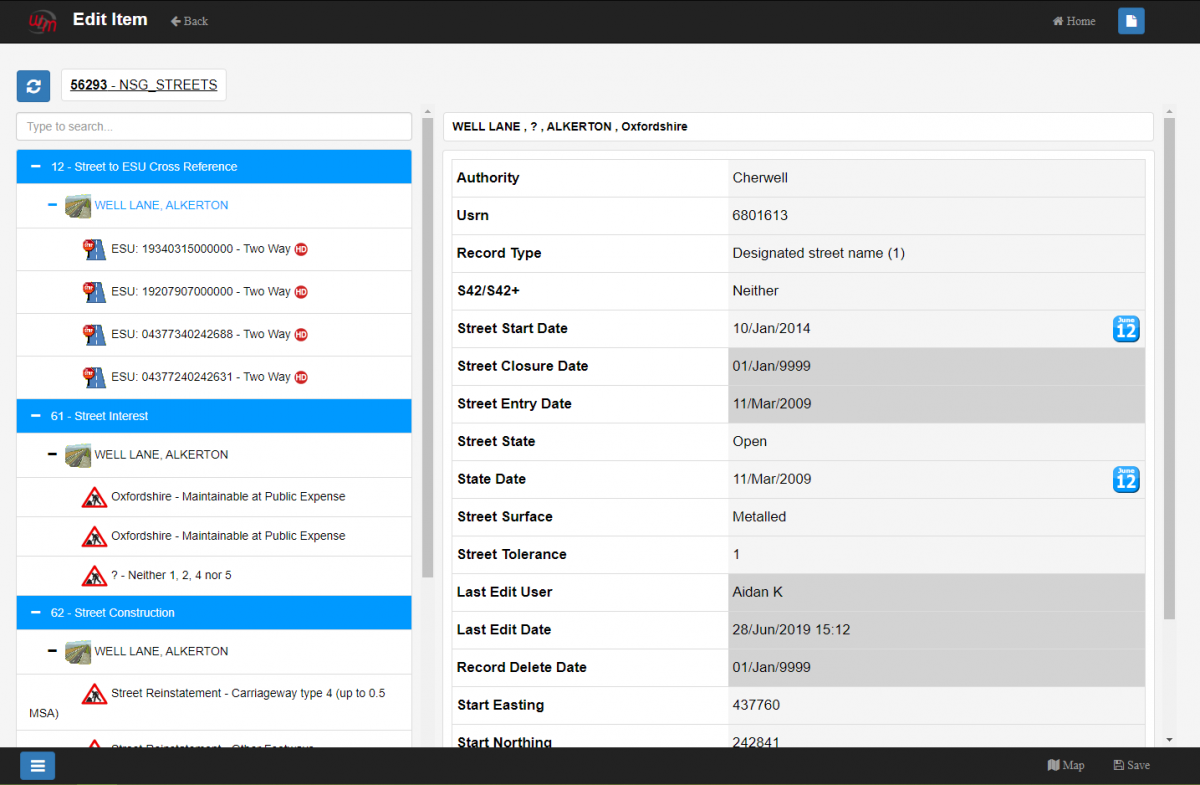
National Street Gazetteer
The NSG is a fundamental cornerstone of the W.D.M. Limited’s Highway Infrastructure Asset Management System and provides national and local highway authorities the proven functionality to update and maintain their highway network. NSG Manager is fully compliant to import / update data from the NSG hub in the latest national current formats.
Two products are provided:
In addition to using NSG, import routines are available for Ordnance Survey Address Point and the Ordnance Survey AddressBase set of products, which include the best parts of Ordnance Survey’s OS MasterMap Address Layer 2 and the Royal Mail Postcode Address File (PAF).
NSG Manager is fully compliant to incorporate the local authority’s Additional Street Data in the latest current formats. This enables HIAMS to display a wealth of information such as ownership, special surfaces, height and weight restrictions, traffic sensitivity and much more about the network and adjacent local authority’s network, including other interested parties.
NSG Manager is:
- BS7666 compliant
- Compliant with Street Manager
- Able to make submissions to the National Hub in the latest Data Transfer Format;
- Able to load downloads from the National Hub in the latest Data Transfer Format;
- Integrate other Council systems either as a regular export, or, through HIAMS rich Web Feature Services
NSG Manager allows authorised users to produce Street Gazetteer and ASD to the latest specification. All changes are fully audited, and options are available to export all data or a subset limited for a specific Highway Authority and/or District.
The WDM® NSG offers supplementary attributes to be defined by authorised users, typically system administrators and allocated against Elementary Street Units. Examples of extended ESU attributes include:
- Class;
- Maintenance Hierarchy;
- Carriageway Type;
- Area Office;
- Environment;
- Speed Limit;
- Parish;
- Ward
All changes to these additional attributes are fully audited and these attributes can be queried using the standard tools, including mapping, provided as part of the HIAMS solution.
All ASD can be queried and displayed using the standard tools provided as part of the HIAMS solution. Examples of this functionality include displaying height and weight restrictions, street ownership, reinstatement types, special surfaces, special designations and one way exemptions etc. thematically mapped against digital map backgrounds or published out via OGC Web Mapping Services and /or Web Feature Services. Additionally, these datasets can also be thematically represented against noticing authority boundaries.
Table Edit provides tools to bulk update Attributes via its user-friendly Graphical User Interface without the need for the user to be skilled in SQL.
Several spatial (import/export) tools are provided. These are:
- Layer Import – for importing data layers for presentation within the HIAMS GIS;
- GIS Export – for extracting any layer data (assets, network etc) in ESRI and MAPINFO formats;
- Spatial Data Loader – converts the data into fully editable layers tied in to all of the WDM® HIAMS Service functionality – e.g. recording defects or condition data etc against asset type.
NSG Manager provides a fully integrated suite of graphical editing tools allowing the creation, deletion, splitting and merging of the base network geometry including USRN’s and Elementary Street Units (ESU).
The user has full control of the allocation of the USRN and a full audit trail and history is provided.


