UKPMS Module
UKPMS accredited System
The W.D.M. Limited Web PMS/UKPMS is our fully accredited pavement management system (PMS). For tasks including national performance reporting, asset management and accounting information on infrastructure assets. The annual UKPMS certification provides assurance to local authorities that the industry-respected UKPMS standards are being maintained and that consistent results are generated.
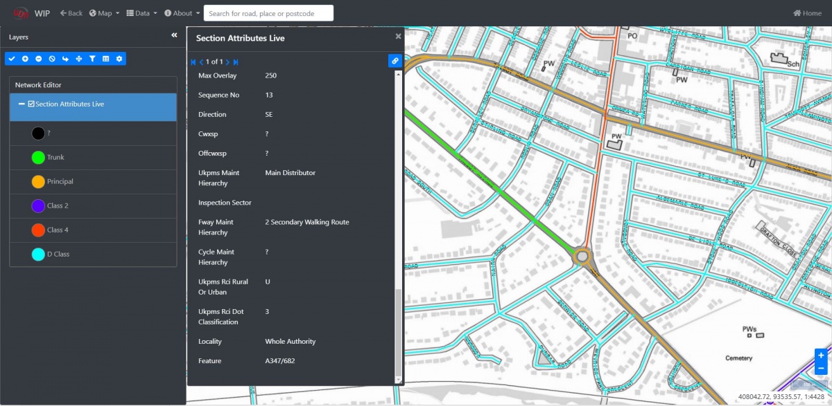
Display of Survey Data and MetaData against Digital BaseMapping
The WIP (Web Information Publisher) allows the display and production of digital images for a wide range of condition survey results, accident locations and other infrastructure assets. The displayed information can either be held in the PMS itself or imported from GIS layers held elsewhere. A wide range of map backgrounds are available either linked to local Web Map Services or hosted by WDM®. The WIP application can also be used to display survey video images.
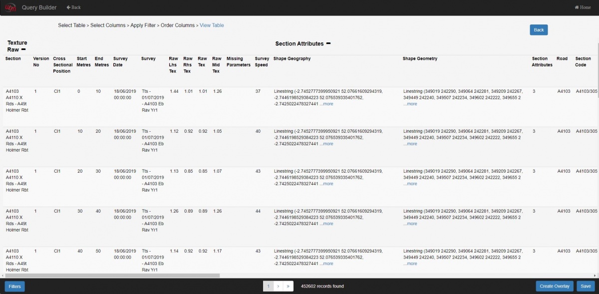
Querying of Survey Data and MetaData
Querying and extracting survey data from the PMS/UKPMS is carried out using the Web Query Builder (WQB). All current and historical survey data and other asset information held in the hosted database can be extracted via the WQB which includes extensive filtering options to enable the extraction of the specific data that the user requires. The data can be viewed and also extracted in cxv, Excel or GIS formats.
Production of National Indicators for England, Scotland, Wales, and Northern Ireland
UKPMS accredited national SCANNER indicator reports can be easily created within the UKPMS report application.
Production of DRC reports
UKPMS accredited annual and gross depreciation reports for carriageways, footways, cycle paths and verges can be quickly and accurately produced for financial asset management returns.
Network Editing functionality
Network details can be edited either using map-based visual or locational co-ordinates or by entering known section codes. Individual section attributes such as speed limits or maintenance hierarchies can be quickly updated on the live hosted network. New sections can be added and digitised assisted by using the available map backgrounds and sections can be end dated whilst retaining all historical survey records.
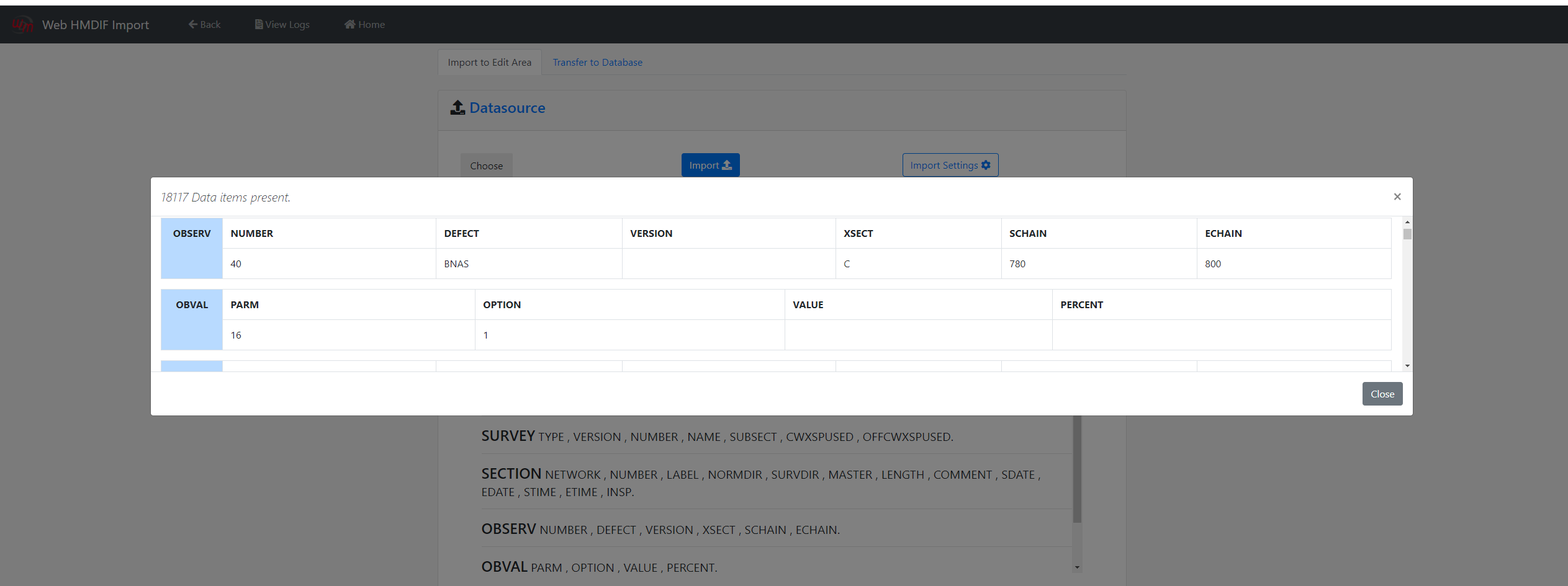
Import and Exporting of HMDIF files
The HMDIF Import and Export applications enable network, inventory, machine, and visual survey records to be transferred from other UKPMS accredited collection and management systems.
Processing of UKPMS Visual Data (e.g. FNS, CVI DVI etc)
The UKPMS Calculation Manager processes DVI, CVI and FNS visual inspection data for the calculation of condition scores, headline indicators and depreciation reports.
Calculation of processed SCANNER data
The UKPMS RCI Calculation Manager processes SCANNER data from a user-defined survey date window to output condition indicators calculated from a selection of standard or user-defined weighting sets. Fixed length summary options are also available for the user to define in addition to the standard 10m subsection averages.