


Scottish NSG
W.D.M. Limited Scottish National Street Gazetteer (SNSG) allows users to maintain and edit the Gazetteer while following the Scottish Gazetteer V4 Conventions. In Scotland, Local Street Gazetteers (LSG) are created and maintained by Local Authorities. They cover all streets in the Authority’s geographic area, regardless of maintenance responsibility. WDM®’s SNSG can export out the required data in a wide range of formats.
SNSG operates within WDM®’s Highway Integrated Asset Management System (HIAMS) while providing validation with the One Scotland Gazetteer (OSG), the definitive source of official address information that conforms to the British Standard and national Conventions.
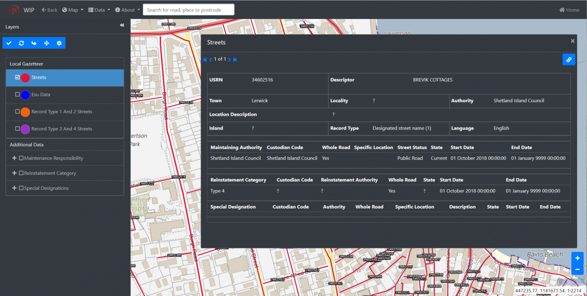
The Scottish NSG allows user to manipulate the map to the precise location required, based on street descriptor, ESU and locality etc or by record start and end dates.
Incorrectly placed ESUs can be removed from a street and added to another street. ESUs can be split and closed off from the original, using tools within SNSG.
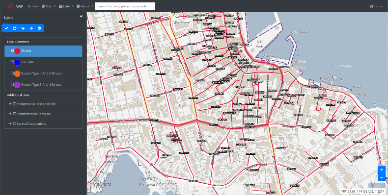
Layers & Validation
Within the mapping software, a range of layers can be set up which can be used to help break down data into an easy-to-read format. These layers can be used to colour code ESUs, asset types (such as road type) and owner types – as the data changes so do the layers. Support for imported layers to show alongside NSG data in the map is included, for example, parish, district and authority polygons.
SNSG supports the adding and editing of polygons for ASD data. These shapes can be snapped to existing geometry on the map. Once the individual record has been saved, it is validated using the Scottish Data Transfer Format from the One Scotland Gazetteer.
WDM®’s NSG allows for the flexibility to include additional ESU/Street attribute fields to store more network information.
Web Query Builder (WQB)
Web Query Builder (WQB) is the SNSG adhoc query tool enabling users or administrators to create their own reports and datasets from the data. This is a very flexible intuitive tool giving access to any published table or view and allowing filtering of data.
Security
WQB integrates with the SNSG security tool SecMan to ensure users only have access to the SNSG data they can view. This is controlled through rights given by the organisations system administrators, for example, a contractor accessing the system can only query their own orders or assets under their control.
Crystal Reports
The ability to generate crystal reports showing mapping (in multiple formats) for viewing is available as an additional addon. Along with the option of a dedicated GeoServer for outputting WFS layers, as a feed for use in third-party GIS software.
For more information call + 44 (0) 117 9567233