Grass roots asset management plan
December 2017
Devon County Council has launched an exciting new grass roots asset management plan to keep its asset database up to date.
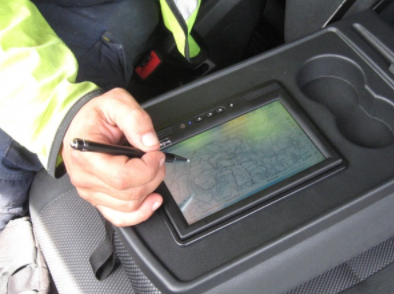
The Council is asking local residents to check and update the highways asset register using a web highway mapping system provided by W.D.M. Limited
For the pilot scheme, two people living in Broadhembury Parish, near Honiton, have been given full access to view and update the highways network information in their area for highway analysis.
The asset data helps the Council make informed decisions and deliver an effective and efficient service, particularly on where best to spend its limited budget on highway engineering and mapping.
The Council had discovered that in some areas the inventory of highway assets, albeit comprehensive, had not been updated since it was originally captured in 1980. This makes it difficult for highway engineering and analysis.
Devon has been publishing an open data copy of the highway assets for some months on its website in both standard digital format and also on maps, which anyone can download creating an effective asset management plan.
However, providing the residents with direct access to enable additions, edits and deletions of definitive data at source, is a new highway mapping concept.
It’s hoped by utilising the web highway mapping solution from WDM, supplier of the Council’s IT solutions, the Council will be able to maintain an up-to-date and fit-for-purpose asset database. This will enable it to facilitate more accurate and risk adverse contractor bids, make better judgements with regards to highway engineering and establish a known asset value for a more effective asset management plan.
The aim is to roll the asset management plan out to other parishes in due course and a Devon County Council spokesman said the ‘Broadhembury pilot’ had generated a lot of interest at a series of Parish & Town Council conferences.
“Several representatives were quick to sign-up to follow Broadhembury’s lead at the end of the pilot in January 2018 and there was a great deal of optimism over the concept and the openness and transparency shown by the authority in making the highway mapping data open. Everyone could see the benefits of working together for a more joined up approach.”
Share this